
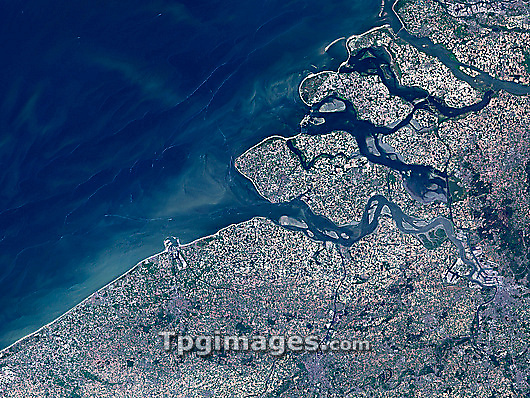
Belgian-Dutch coast, satellite image. North is at top. The land across bottom is in Belgium, while the land at upper right is in the Netherlands. The water at upper left is part of the North Sea. The area seen here is around 135 kilometres across. Prominent features include the Belgian cities of Antwerp (grey/white, lower right), Ghent (grey, bottom centre), and Bruges (grey, lower left). Directly above Bruges, on the coast, is the large port of Zeebruge, with the harbour extending out from the coast. The major feature at upper right is the extensive delta where several major rivers (the Scheldt, bottom; and the Rhine and Meuse, top) reach the sea. Image obtained on 23 May 2001, by the ETM+ sensor on the Landsat 7 satellite.
| px | px | dpi | = | cm | x | cm | = | MB |
Details
Creative#:
TOP03208429
Source:
達志影像
Authorization Type:
RM
Release Information:
須由TPG 完整授權
Model Release:
N/A
Property Release:
N/A
Right to Privacy:
No
Same folder images:
 Loading