
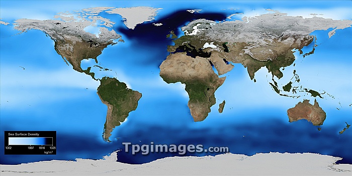
Sea surface density, global map. The density of the surface water of the world's oceans is calculated from measurements of temperature and salinity. Here, light blue regions are of low density, with darker blue being regions of high density. The results show that while the variation is relatively small, there are three stable regions of denser water, one in the north around Iceland, and the other two in the south, associated with Antarctic ice shelves. These masses of water sink, driving the Thermohaline Circulation and the world's deep ocean currents. This has a major effect on the world's climate. The data used in this map is from the World Ocean Atlas 2005.
| px | px | dpi | = | cm | x | cm | = | MB |
Details
Creative#:
TOP06660520
Source:
達志影像
Authorization Type:
RM
Release Information:
須由TPG 完整授權
Model Release:
NO
Property Release:
NO
Right to Privacy:
No
Same folder images:
 Loading