
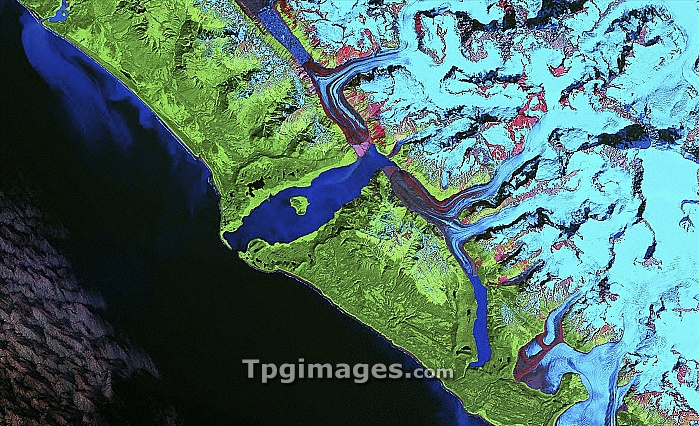
Lituya Bay tsunami damage, Landsat image. This image was obtained around forty years after the 1958 tsunami that was caused by a massive landslide in Lituya Bay, Alaska, USA. This tsunami, reaching a height of 524 metres, was the largest ever recorded. It was caused by a landslide of 30 million cubic metres of mountainside, loosened by an earthquake. The bay is at centre, with the sea at lower left (black) and mountains at upper right (light blue). The coastal area is green, and shallow areas (like the bay) are dark blue. The wave-damaged areas along the rim of the bay are light green, showing where soil and vegetation were removed. This image is from the GeoCover Landsat dataset.
| px | px | dpi | = | cm | x | cm | = | MB |
Details
Creative#:
TOP06662692
Source:
達志影像
Authorization Type:
RM
Release Information:
須由TPG 完整授權
Model Release:
NO
Property Release:
NO
Right to Privacy:
No
Same folder images:
 Loading