
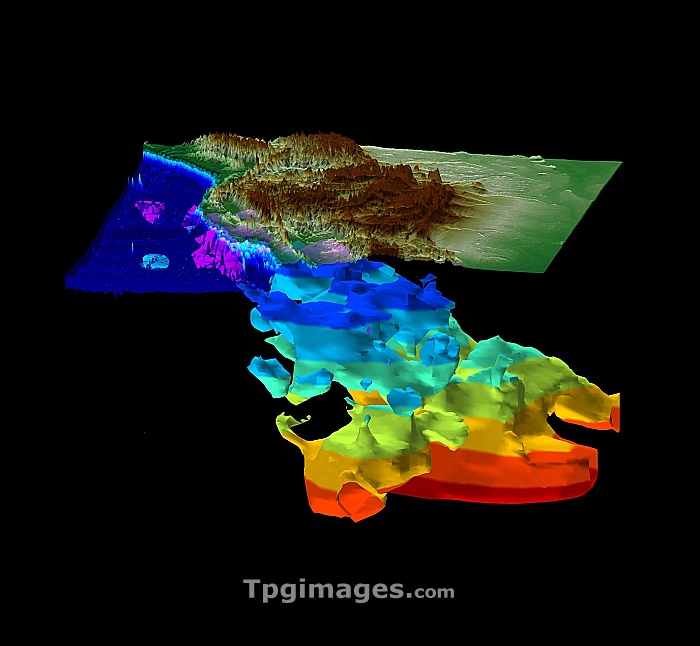
Farallon plate. 3-D computer model of a seismically active slab of the Earth's mantle under western North America known as the Farallon plate. The data for this image was obtained from hundreds of ground-based sensors that measure seismic activity. The data was processed by computer to create a 3-D model using a similar process to 3-D medical tomography. The upper translucent layer is the mountainous land, flanked to the left by the Pacific Ocean. Beneath it is the Farallon plate down to 1,500 kilometres depth. This former piece of ocean crust has been sinking for the past 150 million years. Colours represent 200 kilometre depth intervals.
| px | px | dpi | = | cm | x | cm | = | MB |
Details
Creative#:
TOP07420206
Source:
達志影像
Authorization Type:
RM
Release Information:
須由TPG 完整授權
Model Release:
NO
Property Release:
NO
Right to Privacy:
No
Same folder images:
 Loading