
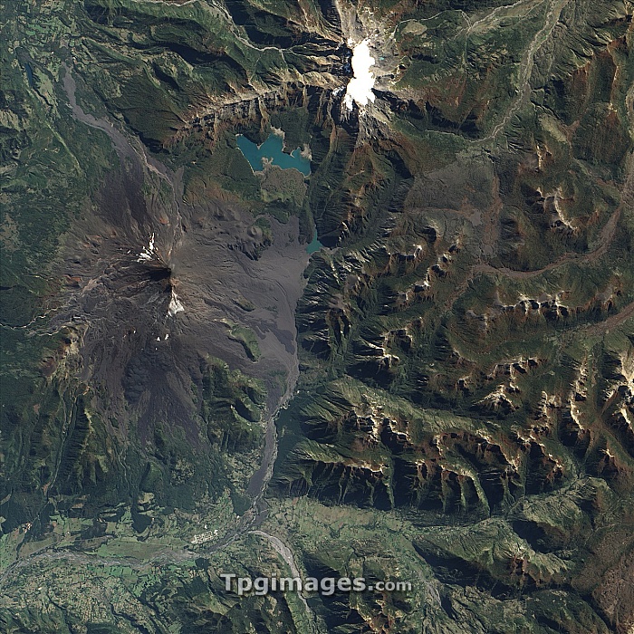
Llaima volcanic eruption, satellite image. North is at top. This volcano (elevation: 3125 metres), located in Conguillio National Park in the Andes mountain range, is one of the most active in Chile. The summit is at centre left, with cinder cones nearby to the north-east, south of Conguillo Lake above them. At top centre is the snow-capped Sierra Nevada volcano (elevation: 2554 metres). At lower left is the settlement of Melipeuco. Llaima volcano eupted in early April 2009, creating these lava flows (grey). This image, around 40 kilometres across, was obtained by the Advanced Land Imager (ALI) sensor on NASA's Earth Observing-1 (EO-1) satellite, on 16 April 2009.
| px | px | dpi | = | cm | x | cm | = | MB |
Details
Creative#:
TOP07420760
Source:
達志影像
Authorization Type:
RM
Release Information:
須由TPG 完整授權
Model Release:
NO
Property Release:
NO
Right to Privacy:
No
Same folder images:
 Loading