
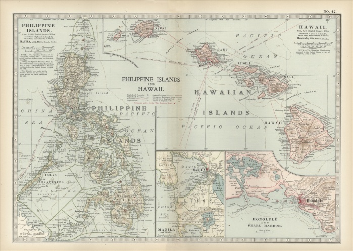
Map of Philippine Islands and Hawaii, with inset maps of Manila, Honolulu, and Pearl Harbor, circa 1902, from the 10th edition of Encyclopaedia Britannica.
| px | px | dpi | = | cm | x | cm | = | MB |
Details
Creative#:
TOP09069789
Source:
達志影像
Authorization Type:
RM
Release Information:
須由TPG 完整授權
Model Release:
No
Property Release:
No
Right to Privacy:
No
Same folder images:
NoPeopleHorizontalHistoryPhysicalGeographySeaCoastlineMapThePastWesternScriptGuidance190219thCenturyStyleIllustrationTechniqueCartographyIllustrationAndPaintingOld-FashionedNavigationalEquipmentExplorationCountryBoundaryGeographicalBorderPhilippineIslandsHawaiiIslandsManilaHonoluluPearlHarborMeridian
190219thAndBorderBoundaryCartographyCenturyCoastlineCountryEquipmentExplorationGeographicalGeographyGuidanceHarborHawaiiHistoryHonoluluHorizontalIllustrationIllustrationIslandsIslandsManilaMapMeridianNavigationalNoOld-FashionedPaintingPastPearlPeoplePhilippinePhysicalScriptSeaStyleTechniqueTheWestern
 Loading