
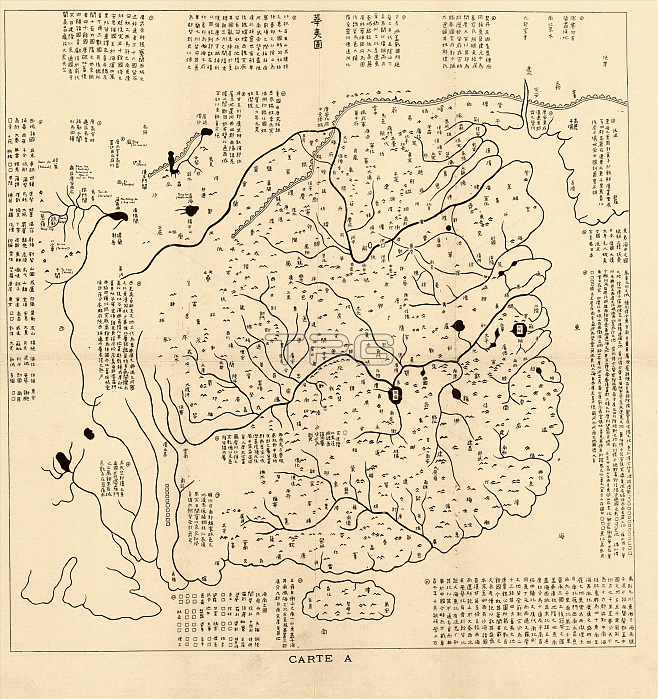
Map of China. Reproduction of a 12th-century map of China, found engraved in stone an dating from 1136 (Fuchang 7 nian). The map covers Nan Song Dynasty China. It ranges from Korea in the east (upper right) to the Pamirs in the west (left), and from the Great Wall of China in the north (top) to the island of Hainan in the south (bottom). The map shows mountains, rivers, lakes, and more than 400 administrative place names. The map is titled 'Hua yi tu', with this stone rubbing copy made in 1903 and published in 'Bulletin de l'Ecole Francaise d'Extreme-Orient'. The original stone map is now in the Forest of Stone Steles Musuem in Xi'an, China.
| px | px | dpi | = | cm | x | cm | = | MB |
Details
Creative#:
TOP16313544
Source:
達志影像
Authorization Type:
RM
Release Information:
須由TPG 完整授權
Model Release:
N/A
Property Release:
N/A
Right to Privacy:
No
Same folder images:
 Loading