
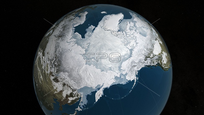
Arctic sea ice record low maximum. Satellite-based image of the maximum (winter) extent of Arctic sea ice for 2016, which set a new record low (14.52 million square kilometres) since records began. The previous record low for the March Arctic maximum had been set the previous year and the record was broken again in 2016. The overall decline averages about 2.8 percent per decade, smaller than the summer (September minimum) trend but still part of the long-term warming trend. The data for this image is from the Advanced Microwave Scanning Radiometer 2 (AMSR2) on JAXA's GCOM-W1 satellite (Global Change Observation Mission).
| px | px | dpi | = | cm | x | cm | = | MB |
Details
Creative#:
TOP16535543
Source:
達志影像
Authorization Type:
RM
Release Information:
須由TPG 完整授權
Model Release:
N/A
Property Release:
N/A
Right to Privacy:
No
Same folder images:
 Loading