
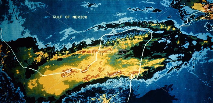
NOAA-7 satellite image of the area around the erupting El Chichon volcano, Yucatan, Mexico, taken on 29th March 1982, 1 day after the eruption began. An infra-red sensor onboard the satellite records the temperature distribution over the area, producing a colour-coded image. The eruption (& subsequent ones on 3rd & 4th April 1982) destroyed about 100 square kilometres of rainforest, sending a sulphur- laden plume of ash 17 kilometres into the atmosphere. During the following weeks a cloud of sulphuric acid vapour encircled the Earth, apparently affecting global weather patterns.
| px | px | dpi | = | cm | x | cm | = | MB |
Details
Creative#:
TOP19843614
Source:
達志影像
Authorization Type:
RM
Release Information:
須由TPG 完整授權
Model Release:
N/A
Property Release:
N/A
Right to Privacy:
No
Same folder images:
 Loading