
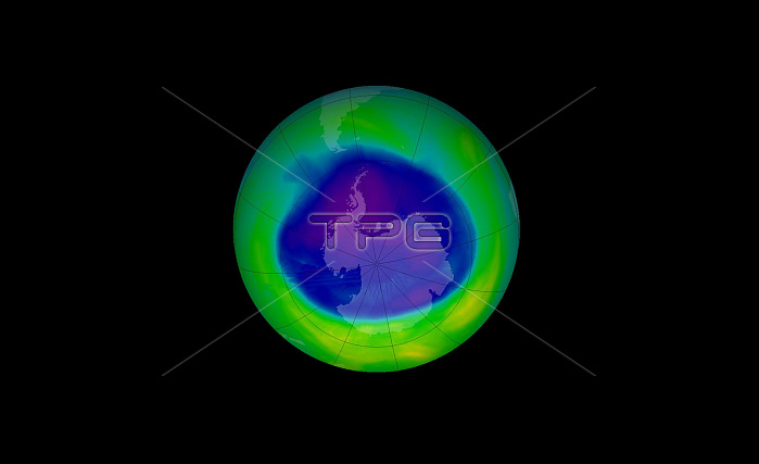
Ozone hole over Antarctica 2005. Image was taken by the satellite Aura which was launched in 2004 to monitor the Earth's atmosphere, including the health of the delicate ozone layer. The Ozone Monitoring Instrument on Aura collected the data used to create this image on September 11, 2005, when the ozone hole covered 27 million square kilometers its peak size for the season. Deep blue shows where ozone levels were low enough to be considered part of the ozone hole. Research shows that the ozone layer may be slower in recovering than previously thought.
| px | px | dpi | = | cm | x | cm | = | MB |
Details
Creative#:
TOP22312589
Source:
達志影像
Authorization Type:
RM
Release Information:
須由TPG 完整授權
Model Release:
N/A
Property Release:
No
Right to Privacy:
No
Same folder images:
 Loading