
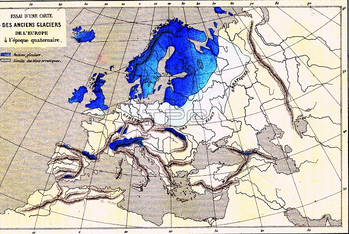
European glaciation, 19th-century illustration. The blue areas show the extent of the ice sheets and glaciers during the last Ice Age, between 20,000 and 18,000 years ago. Areas of land and sea covered by the ice include parts of the North Sea and Baltic Sea, Greenland, Iceland, the British Isles, Scandinavia, and parts of Northern Europe. The mountain ranges of the Alps are also covered in ice. This peak glaciation ended around 10,000 years ago, with the current period being an interglacial where the ice caps have retreated to the polar regions. The light blue area shows the limit of rocks known as glacial erratics, deposited by ancient glaciers. Illustration published in 1864.
| px | px | dpi | = | cm | x | cm | = | MB |
Details
Creative#:
TOP25373358
Source:
達志影像
Authorization Type:
RM
Release Information:
須由TPG 完整授權
Model Release:
N/A
Property Release:
N/A
Right to Privacy:
No
Same folder images:
 Loading