
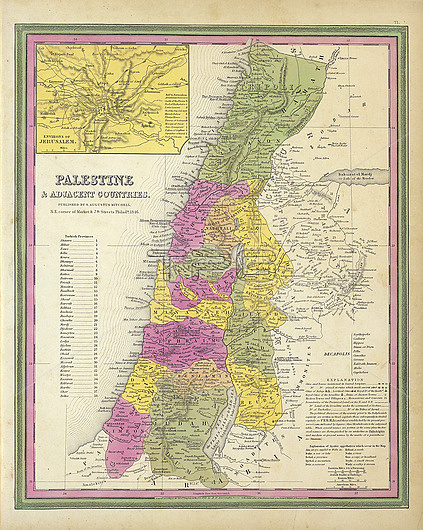
Ancient map of Palestine and adjacent countries by Samuel Augustus Mitchell, published in 1846. In full colour by region with Turkish Provinces numbered and listed.
| px | px | dpi | = | cm | x | cm | = | MB |
Details
Creative#:
TOP26548282
Source:
達志影像
Authorization Type:
RM
Release Information:
須由TPG 完整授權
Model Release:
N/A
Property Release:
N/A
Right to Privacy:
No
Same folder images:
AncientmapPalestineAdjacentcountryregionbiblebiblicalCountriesMitchellSamuelAugustus18461800s19thcenturyfullcolorcolourregionstribetribesIsraelholylandholylandProvincesEnvironsJerusalemS.AugustusMitchelldivisionLandIsraelitemapantiquehistoryhistoricaloldcartographygeographicgeographicalgeographyraremapshebrewshistoryartworkillustrationnobodyno-one
1800s184619thAdjacentAncientAugustusAugustusCountriesEnvironsIsraelIsraeliteJerusalemLandMitchellMitchellPalestineProvincesS.Samuelantiqueartworkbiblebiblicalcartographycenturycolorcolourcountrydivisionfullgeographicgeographicalgeographyhebrewshistoricalhistoryhistoryholyholylandillustrationlandmapmapmapsno-onenobodyoldrareregionregionstribetribes
 Loading