
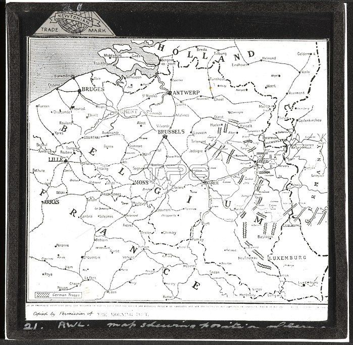
5925362 Map of Belgium, 1914 (lantern slide) by Unknown photographer, (20th century); National Army Museum, London; (add.info.: Map of Belgium, 1914. Lantern slide, World War One, Western Front (1914-1918), 1914. Lantern slides were an important source of public information during the war. They were used to give lectures and slide-shows to people keen to learn more about the conflict. This particular map shows the movement of German troops through Belgium. From a box of 70 lantern slides associated with the German invasion of Belgium, 1914.); by National Army Museum ; out of copyright.
| px | px | dpi | = | cm | x | cm | = | MB |
Details
Creative#:
TOP27784285
Source:
達志影像
Authorization Type:
RM
Release Information:
須由TPG 完整授權
Model Release:
No
Property Release:
No
Right to Privacy:
No
Same folder images:
 Loading