
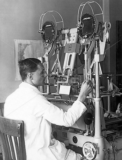
Heinz Gruner of the U.S. Geological Survey doing experimental trials of an aerocartograph to do topographic mapping with aerial images. Washington, D.C.: October 13, 1927.
| px | px | dpi | = | cm | x | cm | = | MB |
Details
Creative#:
TOP29656429
Source:
達志影像
Authorization Type:
RM
Release Information:
須由TPG 完整授權
Model Release:
no
Property Release:
Right to Privacy:
No
Same folder images:
Restriction:
Editorial use only
1person1035-7011920s1927AdultAerocartographAnalysingAutomobileCartographyDCExperimentingHeinzGrunerIndustryMachineMachineryMappingStudySurveyEngineerSurveyingUSGeologicalSurveyUSAUSGSUnitedStatesWashingtonWheelchairdiscoveryeducationengineerexaminingfactoriesfactoryhistoricalhistoryindustrylandtransportationlookingmalemanmidadultmidadultmalemidadultmanonepersonresearchreviewingsittingskillsurveytechnologytransportationworking
11035-7011920s1927AdultAerocartographAnalysingAutomobileCartographyDCEngineerExperimentingGeologicalGrunerHeinzIndustryMachineMachineryMappingStatesStudySurveySurveySurveyingUSUSAUSGSUnitedWashingtonWheeladultadultadultchairdiscoveryeducationengineerexaminingfactoriesfactoryhistoricalhistoryindustrylandlookingmalemalemanmanmidmidmidonepersonpersonresearchreviewingsittingskillsurveytechnologytransportationtransportationworking
 Loading