
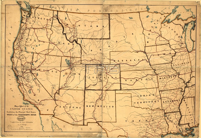
Map of part of the United States exhibiting the principal mail routes west of the Mississippi River, 1867. This map, published in 1867, shows the principal routes for mail delivery throughout the West. Also shown are key hubs for sorting and processing mail, such as Denver, Salt Lake City, and Sacramento. As the United States expanded toward the Pacific Ocean, few services proved more critical than a functioning postal system. Mail delivery became crucial to new settlers writing home, businesses opening branches in the West that had their main offices in cities in the East, and merchants who needed supplies from industries and factories back East." Mail service was also important for government administration and keeping Washington in touch with state and territorial capitals. For a short time in the early 1860s, the Pony Express provided service between Missouri and California along the Oregon Trail, California Trail, and other western routes. Mail later was carried mainly by rail and ship, supplemented by expanding telegraph lines.
| px | px | dpi | = | cm | x | cm | = | MB |
Details
Creative#:
TOP29694892
Source:
達志影像
Authorization Type:
RM
Release Information:
須由TPG 完整授權
Model Release:
Not Required
Property Release:
Not Required
Right to Privacy:
No
Same folder images:
 Loading