
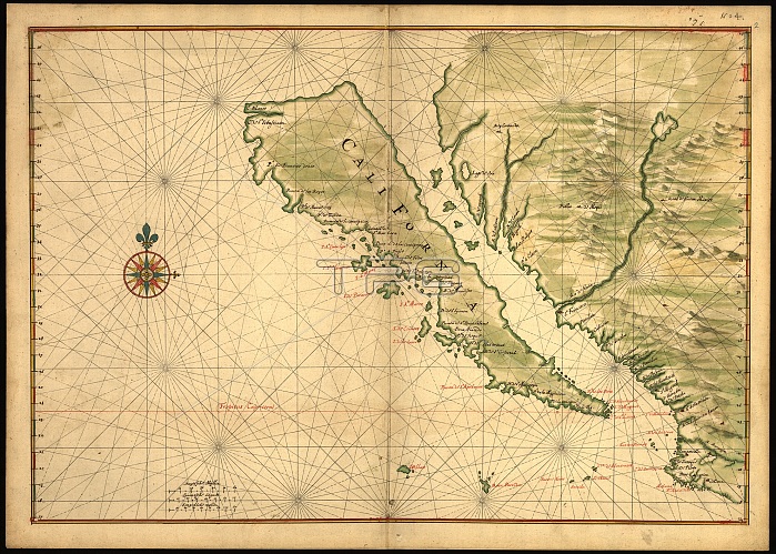
Map of California shown as an island, c 1650. This map from around 1650 shows California as an island. A half-century would pass before Spanish explorers determined with certainty that California was connected to the mainland of North America. Place names are carefully indicated on the map in red and black, and include, for example, Cape San Lucas (at the tip of present-day Baja California), Mexico, and the Tres Maria Islands off the coast of the Mexican mainland. Joan Vinckeboons (1617-70) was a Dutch cartographer and engraver born into a family of artists of Flemish origin. He was in the employ of the Dutch West India Company and produced maps for over 30 years for use by Dutch mercantile and military shipping. He was a business partner of Joan Blaeu, one of the most important map and atlas publishers of the day. Vinckeboons drew a series of 200 manuscript maps that were used in the production of atlases, including Blaeus Atlas Major.
| px | px | dpi | = | cm | x | cm | = | MB |
Details
Creative#:
TOP29694982
Source:
達志影像
Authorization Type:
RM
Release Information:
須由TPG 完整授權
Model Release:
Not Required
Property Release:
Not Required
Right to Privacy:
No
Same folder images:
 Loading