
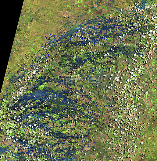
Satellite image showing flooding in New South Wales and along the border in Queensland, Australia on the 29th of October 2022. The rivers and streams shown in the image are part of the Murray-Darling basin, which saw its wettest October on record in 2022. Image obtained by the by Visible Infrared Imaging Radiometer Suite (VIIRS) instruments on the Suomi NPP satellite.
| px | px | dpi | = | cm | x | cm | = | MB |
Details
Creative#:
TOP28862522
Source:
達志影像
Authorization Type:
RM
Release Information:
須由TPG 完整授權
Model Release:
n/a
Property Release:
n/a
Right to Privacy:
No
Same folder images:
 Loading