
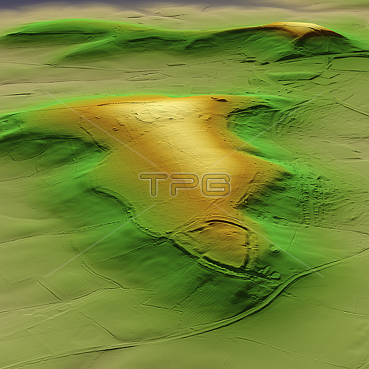
3D LiDAR scan of Borough Hill in Northamptonshire, UK. The digital terrain model offers a view of the surrounding landscape without obstruction from foliage. This is one of many hillforts found across the UK. Remains have been found on the hill of two Iron Age hill forts, two Bronze Age barrows and a Roman villa and farming settlement. These hillforts are typically situated on hilltops and enclosed by earthworks such as ramparts and ditches. They served as fortified settlements or defensive structures for ancient communities, offering protection and control over the surrounding territory. Image contains UK public sector information licensed under the Open Government Licence v3.0.
| px | px | dpi | = | cm | x | cm | = | MB |
Details
Creative#:
TOP29741315
Source:
達志影像
Authorization Type:
RM
Release Information:
須由TPG 完整授權
Model Release:
N/A
Property Release:
N/A
Right to Privacy:
No
Same folder images:
 Loading