
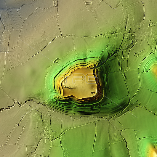
3D LiDAR scan of Cadbury Castle in Somerset, UK. The digital terrain model offers a view of the surrounding landscape without obstruction from foliage. This is one of the largest hillforts of many found across the UK. It dates back to the Bronze Age, over 2000 years ago. It is formed by 73,000 square metres of plateau surrounded by ramparts on the surrounding slopes. As a fortified settlement, Cadbury Castle provided defence and served as a focal point for the local community. During the Iron Age, the fort was occupied by the Durotriges tribe before they were defeated by the Romans in 70 CE. Image contains UK public sector information licensed under the Open Government Licence v3.0.
| px | px | dpi | = | cm | x | cm | = | MB |
Details
Creative#:
TOP29741317
Source:
達志影像
Authorization Type:
RM
Release Information:
須由TPG 完整授權
Model Release:
N/A
Property Release:
N/A
Right to Privacy:
No
Same folder images:
 Loading