
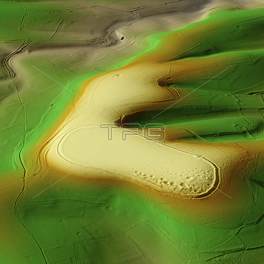
3D LiDAR scan of Cissbury Ring in West Sussex, UK. The digital terrain model offers a view of the surrounding landscape without obstruction from foliage. This is one of the largest hillforts of many found across the UK, covering an area of around 260,000 square metres. It dates back to the Iron Age, over 2000 years ago. These hillforts are typically situated on hilltops and enclosed by earthworks such as ramparts and ditches. They served as fortified settlements or defensive structures for ancient communities, offering protection and control over the surrounding territory. Image contains UK public sector information licensed under the Open Government Licence v3.0.
| px | px | dpi | = | cm | x | cm | = | MB |
Details
Creative#:
TOP29741320
Source:
達志影像
Authorization Type:
RM
Release Information:
須由TPG 完整授權
Model Release:
N/A
Property Release:
N/A
Right to Privacy:
No
Same folder images:
 Loading