
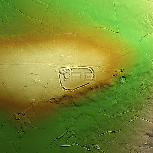
3D LiDAR model of Blackdown Rings, an Iron Age hillfort in Devon, UK. The digital terrain model offers a view of the surrounding landscape without obstruction from foliage. The hillfort consists of earthworks and remains of a medieval ringwork that includes an earth bank, which is 30 metres in diameter at the base, surrounded by a ditch. Hillforts were settlements built on natural hills, fortified with earthworks around the hills contours. These were widely constructed across Britain and Ireland in the centuries leading up to the Roman conquest of these regions. Image contains UK public sector information licensed under the Open Government Licence v3.0.
| px | px | dpi | = | cm | x | cm | = | MB |
Details
Creative#:
TOP29741328
Source:
達志影像
Authorization Type:
RM
Release Information:
須由TPG 完整授權
Model Release:
N/A
Property Release:
N/A
Right to Privacy:
No
Same folder images:
 Loading