
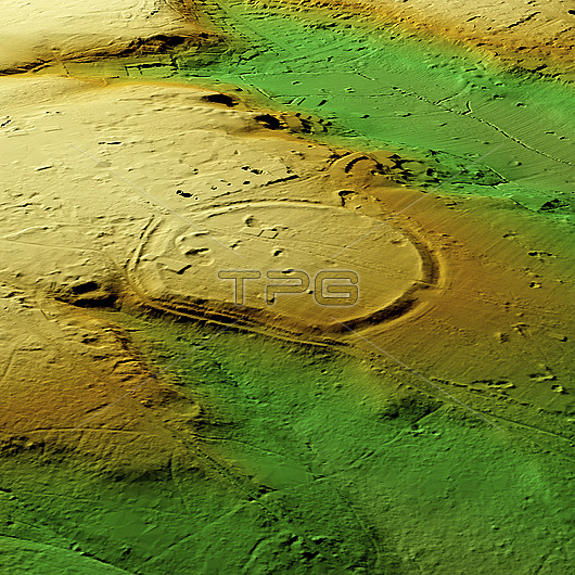
3D LiDAR scan of Caesars Camp, an Iron Age hillfort located in Wimbledon, UK. Hillforts were settlements constructed on natural hills, usually fortified with earthworks around the contours of the hill. They were widely constructed across Europe, Great Britain, and Ireland in the centuries preceding the Roman conquest of the regions. This digital terrain model removes buildings and foliage, providing a view of the site that is mostly hidden by a golf course at the Royal Wimbledon Golf Club in southwest London. The circular contour of the site covers an area of nearly 45000 square meters. The site was granted monument status in 1932 and has been dated by pottery finds to 300 BC. An urn containing 1st century (Roman) coins was also discovered. Image contains UK public sector information licensed under the Open Government Licence v3.0.
| px | px | dpi | = | cm | x | cm | = | MB |
Details
Creative#:
TOP29741397
Source:
達志影像
Authorization Type:
RM
Release Information:
須由TPG 完整授權
Model Release:
N/A
Property Release:
N/A
Right to Privacy:
No
Same folder images:
 Loading