
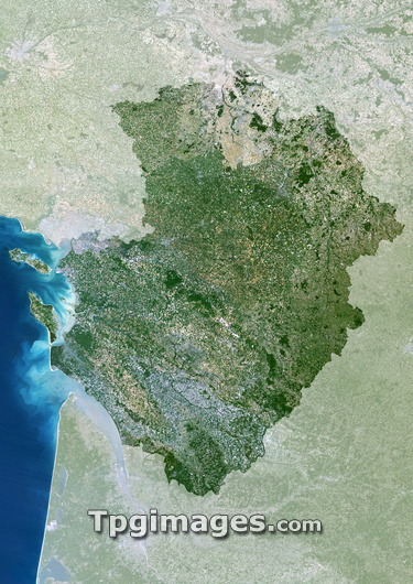
Poitou-Charentes region, France, satellite image. North is at top. Vegetation is shown in green, water in blue, and urban areas in grey. Poitou-Charentes (highlighted) is an administrative region in western France. The Atlantic Ocean lies to the west. The region has a population of around 1.7 million (2005). Its capital is Poitiers, which lies towards the north-east of the region. The two large islands are Ile de Re (north) and Ile d'Oleron (south).
| px | px | dpi | = | cm | x | cm | = | MB |
Details
Creative#:
TOP03206525
Source:
達志影像
Authorization Type:
RM
Release Information:
須由TPG 完整授權
Model Release:
N/A
Property Release:
N/A
Right to Privacy:
No
Same folder images:
 Loading