
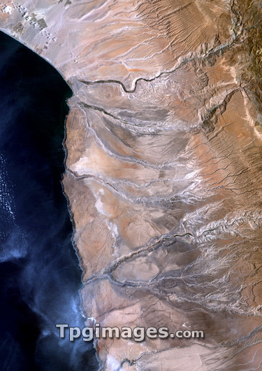
Atacama Desert, Chile and Peru, satellite image. North is at top. The Atacama desert of Chile and Peru is a virtually rainless plateau made up of salt basins (white areas), sand, and lava flows. The desert (light brown) extends from the Andes mountains (partly seen at top right) to the Pacific Ocean (left). Erosion features are seen in the desert, showing where there was once running water. The Peru-Chile border is near the large river channel at top, with Peru to the north. This area is around 100 kilometres across. Image data obtained in 1987.
| px | px | dpi | = | cm | x | cm | = | MB |
Details
Creative#:
TOP03208660
Source:
達志影像
Authorization Type:
RM
Release Information:
須由TPG 完整授權
Model Release:
N/A
Property Release:
N/A
Right to Privacy:
No
Same folder images:
 Loading