
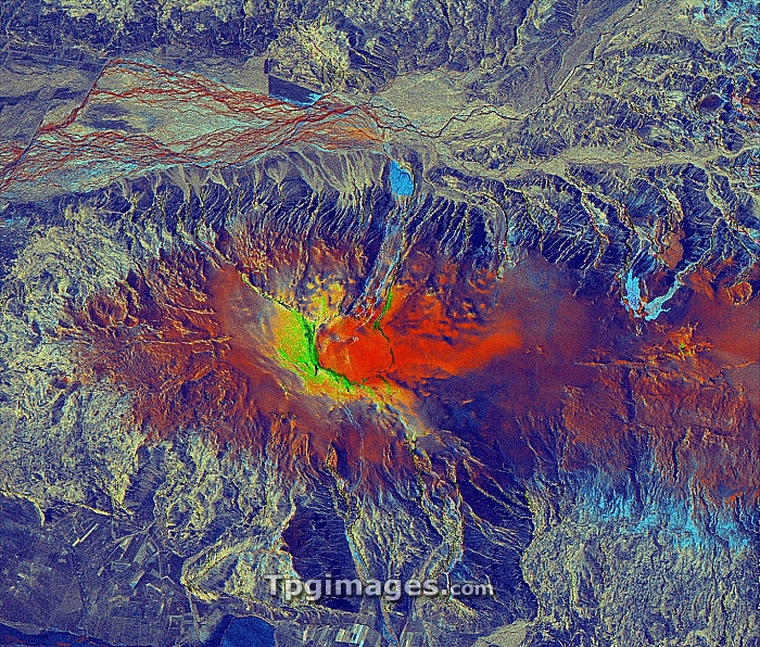
Eyjafjallajokull volcano, Iceland, satellite radar image. North is at top. The ash from the volcanic eruptions under the Eyjafjallajokull glacier in March and April 2010 caused the closure of large parts of European airspace for several days. This composite image shows 25 March (red), 16 April 2010 (green) and the difference (blue). The light blue area (right) was the site of the first eruption. The main eruption took place at centre (red, green and yellow). This area, around 26 kilometres across, was imaged by the TerraSAR-X, a European satellite that uses X-band (microwave) synthetic aperture radar (SAR) to observe the Earth from space.
| px | px | dpi | = | cm | x | cm | = | MB |
Details
Creative#:
TOP07422255
Source:
達志影像
Authorization Type:
RM
Release Information:
須由TPG 完整授權
Model Release:
NO
Property Release:
NO
Right to Privacy:
No
Same folder images:
 Loading