
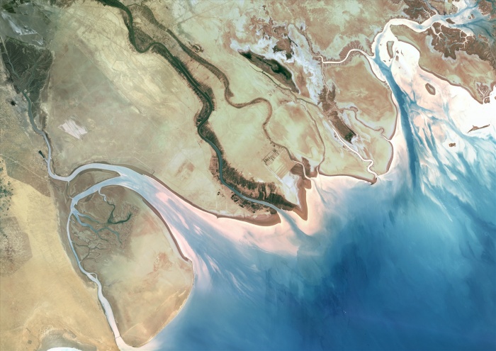
Shatt Al-Arab, Middle East, True Colour Satellite Image. True colour satellite image of Shatt al-Arab Delta, in the Middle East. Shatt al-Arab is a river formed by the confluence of the Euphrates and the Tigris rivers. It flows into the Persian Gulf. Its southern end constitutes the border between Iraq and Iran. The northern part of Kuwait is to be seen at the bottom of the image. Composite image using LANDSAT 7 data.
| px | px | dpi | = | cm | x | cm | = | MB |
Details
Creative#:
TOP09062832
Source:
達志影像
Authorization Type:
RM
Release Information:
須由TPG 完整授權
Model Release:
NO
Property Release:
NO
Right to Privacy:
No
Same folder images:
 Loading