
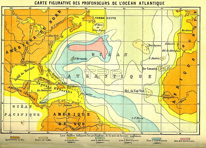
Atlantic Ocean. 1886 map showing the relative depths of the Atlantic Ocean and heights of the surrounding continents of North America (upper left), South America (lower left) and Africa (right).
| px | px | dpi | = | cm | x | cm | = | MB |
Details
Creative#:
TOP16029360
Source:
達志影像
Authorization Type:
RM
Release Information:
須由TPG 完整授權
Model Release:
N/A
Property Release:
N/A
Right to Privacy:
No
Same folder images:
1800s188619thcenturyafricaafricanamericanamericansartworkatlanticoceanbathymetricbathymetrycartographycolor-codedcolour-codeddepthdepthsgeographicalgeographyheightheightshistoricalhistoryhistoryofscienceillustrationmapmappedmappingno-onenobodynorthamericaoceanographysouthamericatopographictopographywater
1800s188619thafricaafricanamericaamericaamericanamericansartworkatlanticbathymetricbathymetrycartographycenturycolor-codedcolour-codeddepthdepthsgeographicalgeographyheightheightshistoricalhistoryhistoryillustrationmapmappedmappingno-onenobodynorthoceanoceanographyofsciencesouthtopographictopographywater
 Loading