
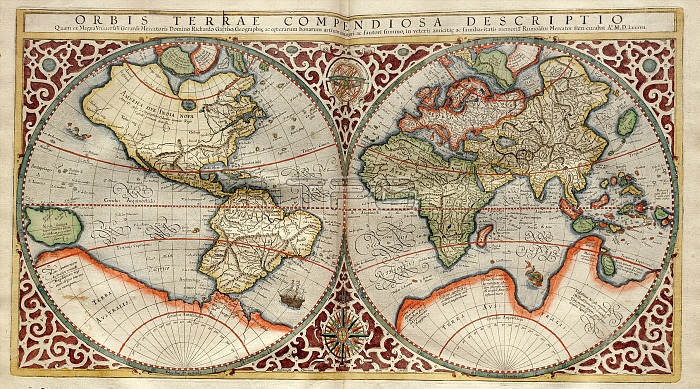
World map, 1595 Mercator atlas. 16th-century Dutch world map, with its Latin title: 'Orbis Terrae Compendiosa Descriptio' It shows the New World being discovered by Europeans exploring the Western Hemisphere. The North and South American continents and the Far East are distorted because they had not yet been accurately mapped. The large Terra Australis continent (white, bottom) represents the unknown far south. This 1587 map by Rumold Mercator is based on the 1569 map by his father, Flemish cartographer Gerardus Mercator (1512-1594). This copy is from 'Atlas Sive Cosmographicae Meditationes' (Duisberg, 1595).
| px | px | dpi | = | cm | x | cm | = | MB |
Details
Creative#:
TOP16235321
Source:
達志影像
Authorization Type:
RM
Release Information:
須由TPG 完整授權
Model Release:
N/A
Property Release:
N/A
Right to Privacy:
No
Same folder images:
 Loading