
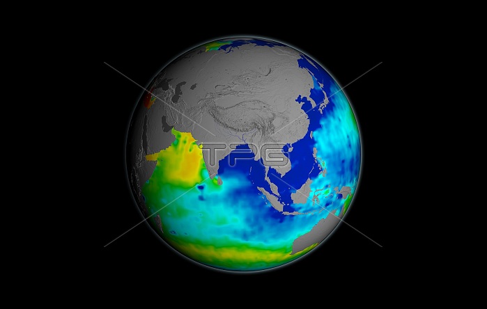
Sea surface salinity. Globe map using Aquarius satellite data for the salinity (dissolved salt-content) of the oceans around Asia in September 2014. Understanding salinity, the amount of dissolved salts in water, helps to better understand the water cycle and can lead to improved climate models. The colour-coding gives the salinity range in PSU (practical salinity units, equivalent to parts per thousand) from 30 (blue) to 35 (green) to 40 (red). Average salinity is 35 PSU, with the normal range from 33 to 37 PSU. This data was acquired by the Aquarius instrument on the joint Argentine-NASA SAC-D satellite.
| px | px | dpi | = | cm | x | cm | = | MB |
Details
Creative#:
TOP16633924
Source:
達志影像
Authorization Type:
RM
Release Information:
須由TPG 完整授權
Model Release:
N/A
Property Release:
N/A
Right to Privacy:
No
Same folder images:
 Loading