
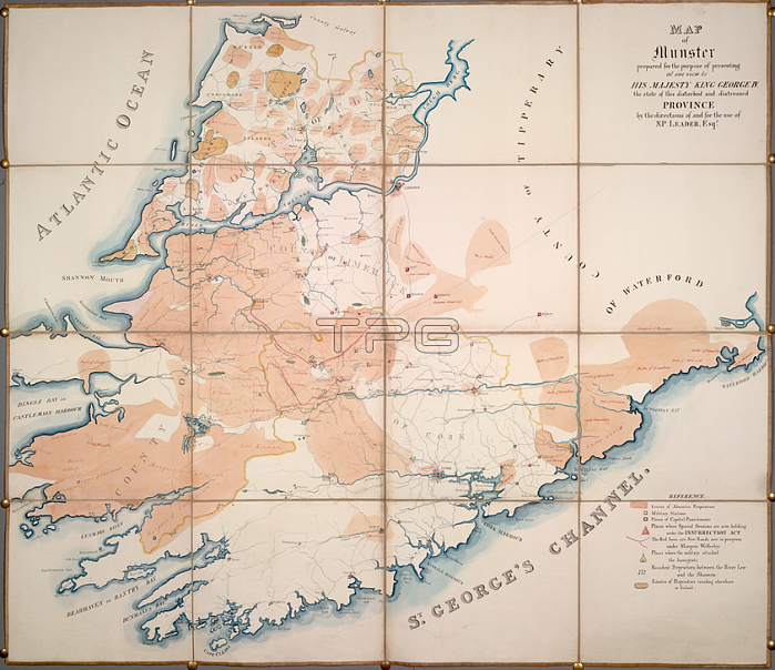
Map of Munster; [Whole map] Map of Munster; relating to the civil unrest in the province. Indicated on the map are the estates of absentee and resident proprietors; military stations; location of special courts; places of capital punishment; new roads; and limestone and coal mines. Prepared for Nicholas Philpot Leader; and probably presented to the Marquess of AngleseyImage taken from Map of Munster.Originally published / produced in Ireland; circa 1828.Ireland; circa 1828.From: Map of Munster.Add. 63632; London; British Library.
| px | px | dpi | = | cm | x | cm | = | MB |
Details
Creative#:
TOP20527055
Source:
達志影像
Authorization Type:
RM
Release Information:
須由TPG 完整授權
Model Release:
No
Property Release:
No
Right to Privacy:
No
Same folder images:
Restriction:
Additional permissions needed for non-editorial use.
 Loading