
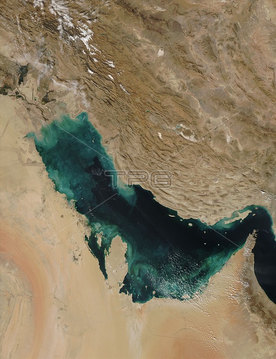
Persian Gulf captured by the MODIS on NASA's Aqua satellite on November 28, 2007. Near the shore, the color is almost certainly sediment washing into the gulf, turning the water tan and then green and finally blue as it disperses. The gulf is deeper on the east near the Iranian shore, where the water is clear and black. Much of the dirt clouding the water in this image is coming from the Shatt al Arab River, which enters the Gulf in the north along the Iran-Iraq border. On the right edge of the image is the narrow Strait of Hormuz, which connects the Persian Gulf to the Arabian Sea, part of the northern Indian Ocean. The Persian Gulf is flanked by the Arabian Peninsula with its vast tan, pink and white sand deserts on the southwest and the dry mountains of southwest Asia on the northeast. The wetlands and rivers of Mesopotamia border the gulf on the north. Snow dusts the mountains in the north. The region is rich in oil, and the red dots that typically mark fire locations in MODIS imagery may actually be gas flares in the oil fields, particularly along the northern shore of the gulf in Iran and Iraq.
| px | px | dpi | = | cm | x | cm | = | MB |
Details
Creative#:
TOP22085278
Source:
達志影像
Authorization Type:
RM
Release Information:
須由TPG 完整授權
Model Release:
N/A
Property Release:
No
Right to Privacy:
No
Same folder images:
 Loading