
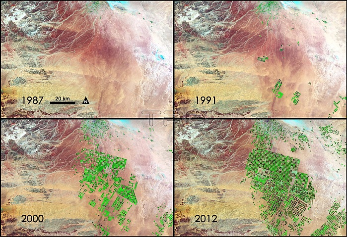
Saudi Arabia is drilling for a resource possibly more precious than oil. Over the last 24 years, it has tapped hidden reserves of water to grow wheat and other crops in the Syrian Desert. This time series of data shows images acquired by three different Landsat satellites operated by NASA and the U.S. Geological Survey. In this series of four Landsat images, the agricultural fields are about one kilometer (.62 miles) across. The images were created using reflected light from the short wave-infrared, near-infrared, and green portions of the electromagnetic spectrum (bands 7, 4, and 2 from Landsat 4 and 5 TM and Landsat 7 ETM+ sensors). Using this combination of wavelengths, healthy vegetation appears bright green while dry vegetation appears orange. Barren soil is a dark pink, and urban areas, like the town of Tubarjal at the top of each image, have a purple hue.
| px | px | dpi | = | cm | x | cm | = | MB |
Details
Creative#:
TOP22304029
Source:
達志影像
Authorization Type:
RM
Release Information:
須由TPG 完整授權
Model Release:
N/A
Property Release:
No
Right to Privacy:
No
Same folder images:
 Loading