
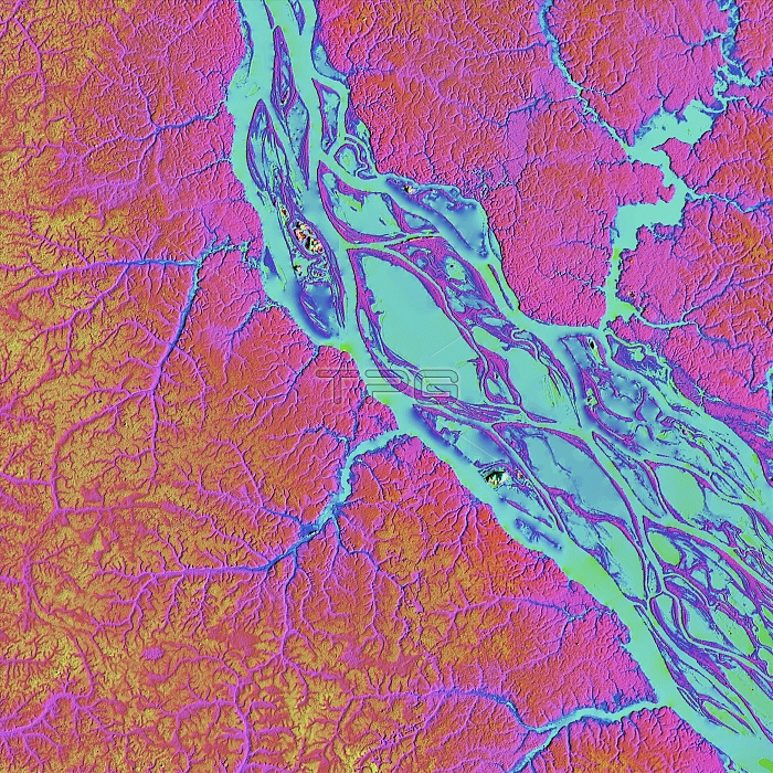
Rio Negro in the Amazon, LiDAR satellite image. The Rio Negro is one of the largest tributary rivers of the Amazon. This area, just north-west of Manaus, the capital of the Brazilian state of Amazonas, is around 50 kilometres across. LiDAR combines optical and laser imaging to produce digital elevation maps (DEMs), with differences in elevation shown by the colour-coding of the image. Image data obtained by the radar and optical sensors on the Advanced Land Observation Satellite (ALOS) of the Japan Aerospace Exploration Agency (JAXA).
| px | px | dpi | = | cm | x | cm | = | MB |
Details
Creative#:
TOP25469162
Source:
達志影像
Authorization Type:
RM
Release Information:
須由TPG 完整授權
Model Release:
N/A
Property Release:
N/A
Right to Privacy:
No
Same folder images:
 Loading