
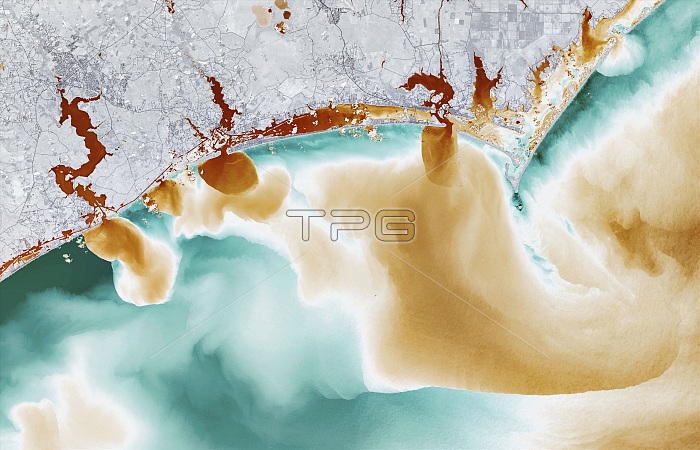
North Carolina flooding, September 2018, satellite image. This flooding was caused by Hurricane Florence, which made landfall here on 14 September 2018, with 8 trillion gallons of rain falling on North Carolina over the course of 5 days. This image (around 120 kilometres across) shows the Atlantic coast near Cape Lookout (upper right), with outflows from (left to right): New River, White Oak River, and Adams Creek. This image combines visible and infrared data, showing the amount of coloured dissolved organic matter (CDOM). High levels of CDOM are orange-brown, indicating a large amount of run-off from the lands in the form of floodwaters swelling the rivers. Image obtained on 19 September 2018, by the the Operational Land Imager (OLI) on the Landsat 8 satellite. For the visible colour version of this image, see C048/2036.
| px | px | dpi | = | cm | x | cm | = | MB |
Details
Creative#:
TOP25499384
Source:
達志影像
Authorization Type:
RM
Release Information:
須由TPG 完整授權
Model Release:
N/A
Property Release:
N/A
Right to Privacy:
No
Same folder images:
 Loading