
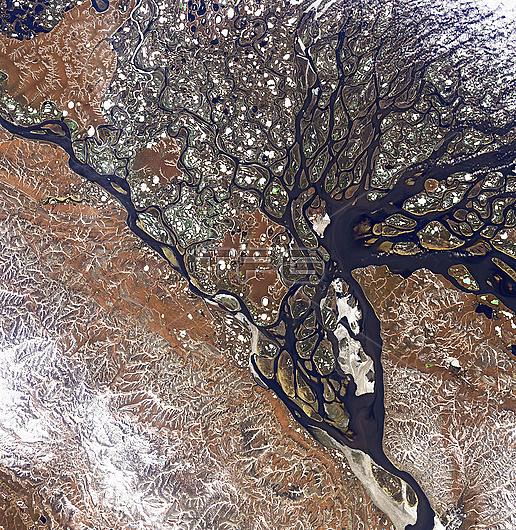
Natural colour satellite image of the Lena river delta in Siberia. Some of the ponds appear green because they have a layer of melt water over a lower layer of ice. The Lena is one of three Siberian rivers that flow into the Arctic Ocean. It is 4,294 kilometres long, and has a drainage basin of 2,490,000 square kilometres. Data obtained by the Operational Land Imager (OLI) on NASA's Landsat 8 satellite.
| px | px | dpi | = | cm | x | cm | = | MB |
Details
Creative#:
TOP26298631
Source:
達志影像
Authorization Type:
RM
Release Information:
須由TPG 完整授權
Model Release:
N/A
Property Release:
N/A
Right to Privacy:
No
Same folder images:
 Loading