
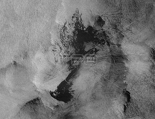
Grande America oil spill, satellite radar image. The Italian container ship 'Grande America' was carrying over 2000 tonnes of heavy fuel when it caught fire and sank in the Atlantic on 12 March 2019 in the Bay of Biscay, around 300 kilometres off the coast of France. The sinking produced this oil spill (dark patch), around 50 kilometres long. The white dots in the oil spill are boats assisting in the clean-up operation. The oil spill is threatening the coastal areas around La Rochelle, Biarritz and Vendee in France. Radar image obtained on 19 March 2019 by the satellites of the ESA's Copernicus Sentinel-1 mission.
| px | px | dpi | = | cm | x | cm | = | MB |
Details
Creative#:
TOP27285610
Source:
達志影像
Authorization Type:
RM
Release Information:
須由TPG 完整授權
Model Release:
N/A
Property Release:
N/A
Right to Privacy:
No
Same folder images:
 Loading