
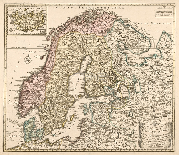
Cartography in the 18th century; Scandinavia with 1 map of Iceland; Map of Scandinavia; colored by country; bordered in yellow; map of Iceland l.b. Turned north slightly to the right; l.m. wind rose. R.b. scale in Swedish; Danish-German and French miles. Inscription: Carte la plus Nouvelle / DE LA SCANDINAVIE OU LES / COURONNES DU NORD / Scavoir / LA SUEDE LE DANEMARC et LA NORVEGE / Ou Lon Trouve LA MER BALTIQUE et une / Grande Partie de la MOSCOVIE etc. Signed; ro: par REGNER et IOSUE OTTENS; Scandinavia; Iceland; Reinier Ottens (I); Amsterdam; 1700 - 1750; paper; engraving; h 51.3 cm x w 59.4 cm
| px | px | dpi | = | cm | x | cm | = | MB |
Details
Creative#:
TOP28295363
Source:
達志影像
Authorization Type:
RM
Release Information:
須由TPG 完整授權
Model Release:
No
Property Release:
No
Right to Privacy:
No
Same folder images:
 Loading