
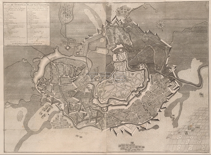
Map of Temesv醨; 1716 Plan de Temiswar and the surrounding areas of the Atacta dans la Palanque (...) / Plais of Temiswar and its surrounding areas; and a Design to strengthen it (title on object); Map of Temesv醨 (in present-day Romania); captured from the Turks on October 13; 1716. Numbered bottom right: Tom. II. No. 61. Illustration in the second part of: [Jean] du Mont; War description of the battles and sieges; of the three ... well-known kryg superiors ... the Prince Eugene of Savoy; the ... Duke of Marlborough; and the Prince van Oranje and Nassau-Vriesland; in the 1729 edition. This second part is mainly devoted to the acts of the Duke of Marlborough and Prince Johan Willem Friso; maps of cities; siege; position war; Timisoara; anonymous; 1716 and/or 1729; paper; etching; h 700 mm x w 940 mm
| px | px | dpi | = | cm | x | cm | = | MB |
Details
Creative#:
TOP28311181
Source:
達志影像
Authorization Type:
RM
Release Information:
須由TPG 完整授權
Model Release:
No
Property Release:
No
Right to Privacy:
No
Same folder images:
 Loading