
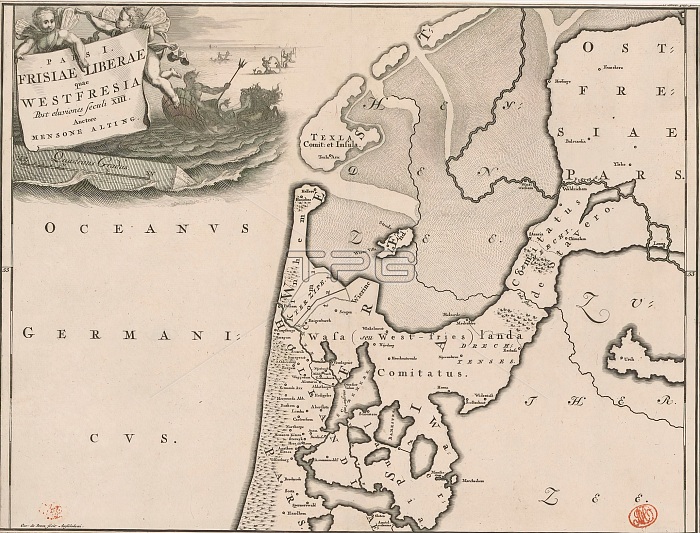
Historical map of the Netherlands with the territories of the Batavians and Frisians, Pars I Frisiae Liberae quae Westfresia (...) (title on object), Map of Frisian territories in West Friesland in Roman times. Top left cartouche with title, above two putti. Right of cartouche in background Neptune and several tritons. Scale stick below cartouche: Quadrans gradus. Degrees along left and right edges. print maker: Gerrit de Broen (I), (mentioned on object), print maker: Joseph Mulder, (mentioned on object), after own design by: Joseph Mulder, (mentioned on object), print maker: Amsterdam, print maker: Netherlands, 1697 - 1700 and/or 1725, paper, engraving, etching, height 317 mm x width 420 mm.
| px | px | dpi | = | cm | x | cm | = | MB |
Details
Creative#:
TOP28937952
Source:
達志影像
Authorization Type:
RM
Release Information:
須由TPG 完整授權
Model Release:
No
Property Release:
No
Right to Privacy:
No
Same folder images:
 Loading