
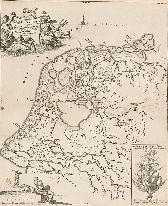
Historical map of the Netherlands with the territories of the Batavians and Frisians, Typus Frisiae veteris (...) insulae Batavorum (...) (title on object), Map of the Frisian and Batavian territories in the Netherlands in Roman times. Top left cartouche with title, surrounded by Neptune and a number of tritons. Bottom left cartouche with scale bar: Milliaria Germanica communia. Above this cartouche two Germanic warriors (possibly Frisians). Bottom right a cartouche depicting the plant water sorrel (Rumex hydrolapathum). This plant, according to Pliny, was used by the Frisians to combat scurvy. print maker: Caspar Luyken, Bernardus Schotanus a Sterringa, (mentioned on object), publisher: Francois Halma, (mentioned on object), print maker: Netherlands, publisher: Leeuwarden, 1697 - 1700 and/or 1718 and/or 1725, paper, engraving, etching, height 485 mm x width 398 mm.
| px | px | dpi | = | cm | x | cm | = | MB |
Details
Creative#:
TOP28937954
Source:
達志影像
Authorization Type:
RM
Release Information:
須由TPG 完整授權
Model Release:
No
Property Release:
No
Right to Privacy:
No
Same folder images:
 Loading