
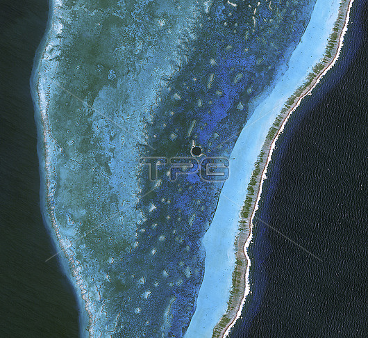
Satellite image of the Great Blue Hole (at centre) in Belize. This is a vertical cave located in Belizes Lighthouse Reef Atoll. It measures roughly 300 metres across and 125 metres deep, making it a popular diving destination. It likely formed during the last Ice Age, when global sea levels were much lower. The marine sinkhole contains many geologic features, including limestone stalactites and stalagmites. The shallow waters and pale corals in the Lighthouse Reef Atoll create varying shades of blue-green, with the ring of lighter colour surrounding the Hole caused by elevated coral. To the east, a broad band of aquamarine indicates an area of especially shallow water along the reefs margin. The reef crests the ocean surface along its easternmost edge, where breaking waves from the Caribbean Sea form a jagged line of white. Image obtained on 24 March 2009 by NASAs Advanced Land Imager (ALI) on the Earth Observing-1 satellite (EO-1).
| px | px | dpi | = | cm | x | cm | = | MB |
Details
Creative#:
TOP29656675
Source:
達志影像
Authorization Type:
RM
Release Information:
須由TPG 完整授權
Model Release:
N/A
Property Release:
N/A
Right to Privacy:
No
Same folder images:
 Loading