
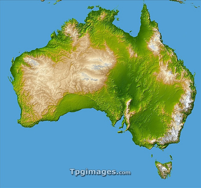
Australia. Computer-enhanced topographical image of the continent of Australia, which covers an area of over 7.5 million square kilometres, and is the smallest and flattest of the continents. At far right is the Great Dividing Range (beige). The Lake Eyre Basin (dark green, centre right) is 16 metres below sea level and is one of the world's largest drainage systems. The green upside-down 'U' (centre left) is the Nullarbor Plain, a low- lying limestone plateau. The island of Tasmania is at bottom right. This image was obtained by combining shading and colour coding of topographic height. The data were acquired on the Shuttle Radar Topographic Mission (SRTM, Space Shuttle Endeavour, February 2000).
| px | px | dpi | = | cm | x | cm | = | MB |
Details
Creative#:
TPG05323655
Source:
達志影像
Authorization Type:
RF
Release Information:
須由TPG 完整授權
Model Release:
NO
Property Release:
NO
Right to Privacy:
No
Same folder images:
 Loading