
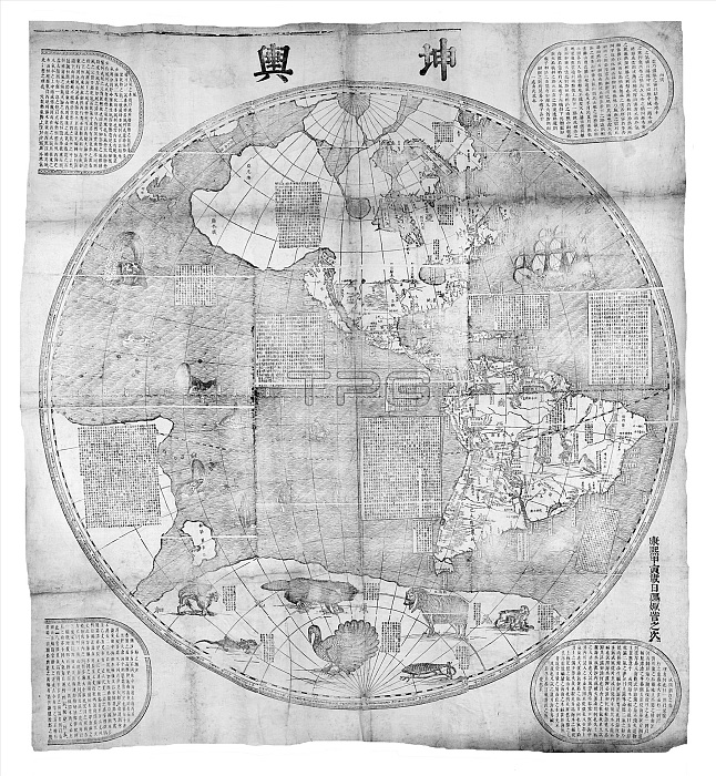
This map showing the two hemispheres of the world was made for the 2nd Qing Emperor, Kangxi (1662-1722) by the Jesuit Ferdinand Verbiest (1623-88), in 1674. Verbiest was one of a few Jesuits who were employed at the Chinese court during the period.
Printed from woodblocks using Mercator's projection, the map was part of a larger geographical work called Kunyu tushuo (Illustrated Discussion of the Geography of the World) and called: Kunyu wanguo quantu (A Map of the Myriad Countries of the World). It was one of a series of maps produced by the Jesuits at the Court in Beijing, beginning with Matteo Ricci's two maps of 1584 and 1602.
| px | px | dpi | = | cm | x | cm | = | MB |
Details
Creative#:
TPG32667779
Source:
達志影像
Authorization Type:
RF
Release Information:
須由TPG 完整授權
Model Release:
No
Property Release:
No
Right to Privacy:
No
Same folder images:
 Loading