
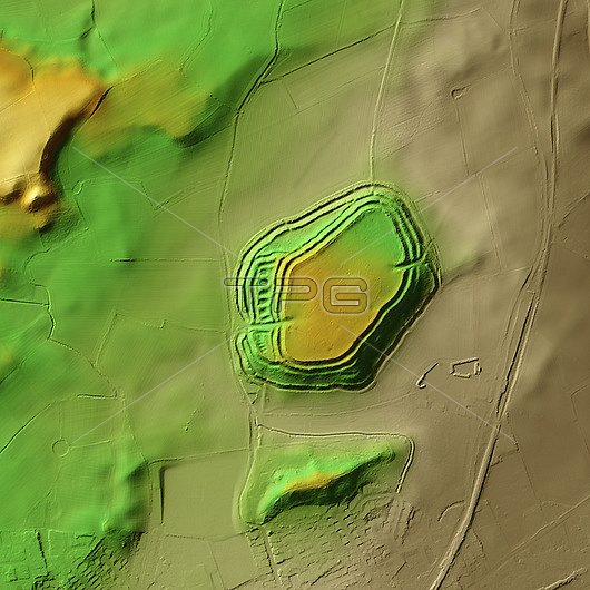
3D LiDAR model of Old Oswestry in Shropshire, UK. The digital terrain model offers a view of the surrounding landscape without obstruction from foliage. Old Oswestry was built and occupied during the Iron Age (800 BCE to 43 CE) and is one of the best-preserved hillforts in Britain. Hillforts were widely constructed across Britain and Ireland in the centuries leading up to the Roman conquest of these regions. This is a fine example of a multivallate or multiple rampart hillfort. It remained in use for almost 1,000 years. Image contains UK public sector information licensed under the Open Government Licence v3.0.
| px | px | dpi | = | cm | x | cm | = | MB |
Details
Creative#:
TOP29741332
Source:
達志影像
Authorization Type:
RM
Release Information:
須由TPG 完整授權
Model Release:
N/A
Property Release:
N/A
Right to Privacy:
No
Same folder images:
 Loading