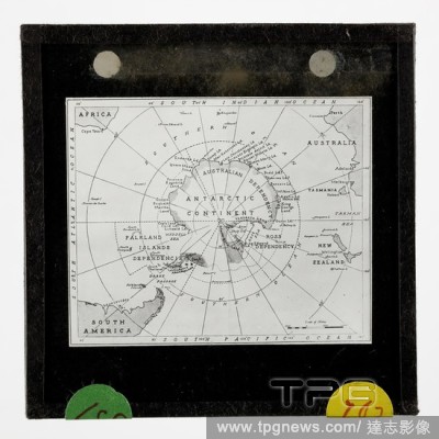
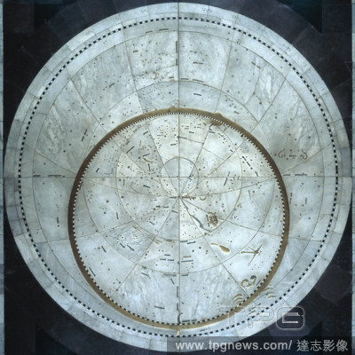
EditorialLantern Slide - Chart Depicting BANZARE Australian Claims, Antarctica, 1929-1930, Lantern slide of a map of Antarctica, showing the Australian Dependency - obviously resulting from the BANZARE Voyage 1 discoveries and claims, initially in the name of t...
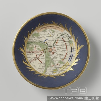
EditorialSaucer with a strategic map of the Battle of Leipzig, Porcelain dish with a spreading wall, painted on the glaze in matt blue, red, green, yellow, black and gold. On the shelf a medallion of golden leaf vines with a strategic map of the battle of Leipz...
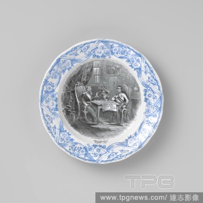
EditorialPlate, with two soldiers on the shelf at a table on which is a map, Plate of earthenware with black and blue transfer decor. The shelf is decorated with a black transfer decor, the border with a blue transfer decor. On the shelf a representation of two...
EditorialGlobe in wooden chair made by G. Valck or Valk, The chair has four legs with round feet, here and there woodworm holes. The horizontal protractor is made of wood (broken in one place and a bar comes through the paper in another) and covered with paper....
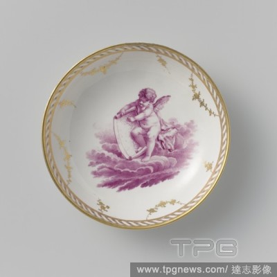
EditorialSaucer with a putto on clouds, Porcelain dish, painted on the glaze in pink (camaieu) and gold. On the shelf a putto with a world map on a cloud. On the card the inscription 'MARCKIES' [?]. The inner edge with a twisted band, on which garlands and flow...
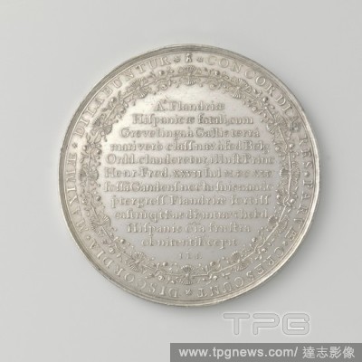
EditorialCapture of Sas van Gent by Frederik Hendrik, Silver Medal. Front: map of the captured fortress. Reverse: inscription within a wreath of arrows and orange branches within an inscription, Sas-van-Gent, Zeeland, Frederik Hendrik (Prince of Orange), Johann...
EditorialLantern Slide - Chart Depicting BANZARE Australian Claims, Antarctica, 1929-1930, Lantern slide of a map of Antarctica, showing the Australian Dependency - obviously resulting from the BANZARE Voyage 1 discoveries and claims, initially in the name of t...
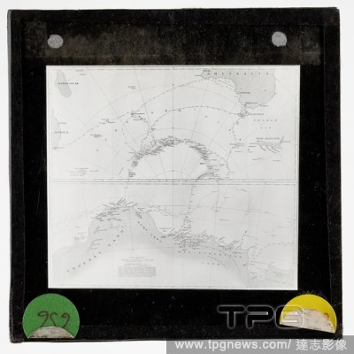
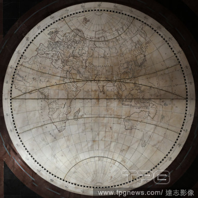
EditorialLantern Slide - Two Charts Depicting BANZARE Voyages, Antarctica, 1929-1931, Lantern slide of a map showing the tracks of the Discovery - 1929-30, 1930-31 and a track for the 1,000 fathom line (approx). A split slide - showing the Banzare Expedition of...
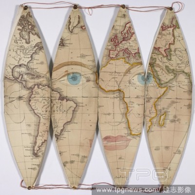
EditorialSegments of a map, showing human eyes and lips. Stokes's Capital Mnemonical Globe. London, 1868. This Globe, when expanded, is intended to represent the figure of the human head. [8 segments to form a Globe 8 inches in diameter]. Source: Maps.C.4.a.6. ...
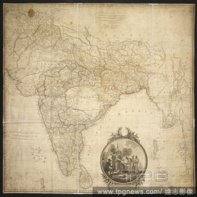
EditorialA map of Hindoostan. Hindoostan. By J. Rennell, F.R.S., 1782 ... The map engd. by J. Phillips. The writing by W. Harrison. 100 Geographical miles[ = 44 mm.]. (Memoir of a map of Hindoostanl; or the Mogul's Empire. With an examination of some positions ...
EditorialKingsclere- a Roman road is shown, running diagonally upwards from the lower left of the map, noting its local name: 'Devil's Bank'. 1808. Pen and ink on paper. Source: OSD 79. Language: English.


 Loading