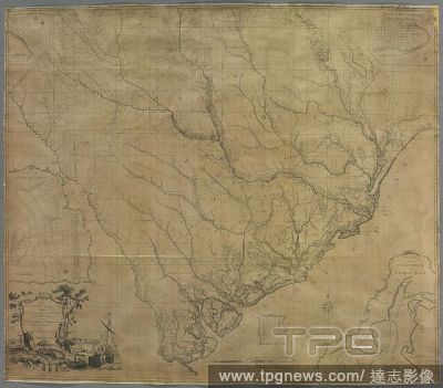
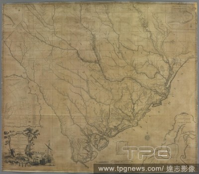
EditorialA map of South Carolina. A MAP of SOUTH CAROLINA. With all the Islands, Marshes, Swamps, Bays, Rivers, Creeks, Inland Navigations, And all the COUNTYS, DISTRICTS, TOWNS, ROADS, COUNTY, PARISH, and PROVINCIAL LINES; From an ACTUAL SURVEY. [London] : Pub...
EditorialA map of South Carolina. A MAP of SOUTH CAROLINA. With all the Islands, Marshes, Swamps, Bays, Rivers, Creeks, Inland Navigations, And all the COUNTYS, DISTRICTS, TOWNS, ROADS, COUNTY, PARISH, and PROVINCIAL LINES; From an ACTUAL SURVEY. [London] : Pub...
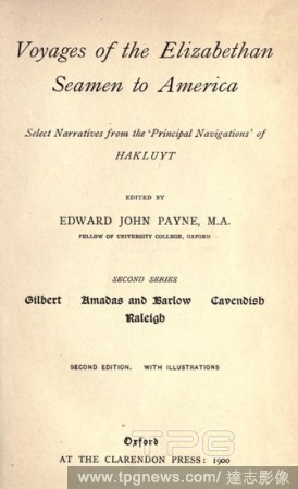
EditorialVoyages of the Elizabethan seamen to America : select narratives from the Principal navigations of Hakluyt ;Gilbert, Amadas and Barlow, Cavendish, Raleigh : Hakluyt, Richard, 1552?-1616.
EditorialVoyages of the Elizabethan seamen to America; select narratives from the 'Principal navigations' of Hakluyt. Ed. by Edward John Payne ... 2d series : Hakluyt, Richard, 1552?-1616.
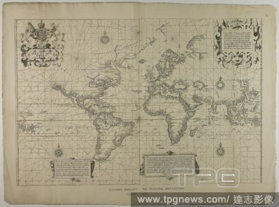
EditorialRichard Hakluyt, the Principal Navigations, London. Unknown Artist (English, 19th century); from the original collection of Richard Hakluyt (English, 1552-1616). Date: 1889. Dimensions: . Engraving in black on cream wove paper. Origin: England.
EditorialRichard Hakluyt, the Principal Navigations, London. Unknown Artist (English, 19th century); from the original collection of Richard Hakluyt (English, 1552-1616). Date: 1889. Dimensions: . Engraving in black on cream wove paper. Origin: England.
EditorialRichard Hakluyt, the Principal Navigations, London. Unknown Artist (English, 19th century); from the original collection of Richard Hakluyt (English, 1552-1616). Date: 1889. Dimensions: . Engraving in black on cream wove paper. Origin: England.
EditorialRichard Hakluyt, the Principal Navigations, London. Unknown Artist (English, 19th century); from the original collection of Richard Hakluyt (English, 1552-1616). Date: 1889. Dimensions: . Engraving in black on cream wove paper. Origin: England.
EditorialLes Yurongnes. Les quatres premiers livres des Navigations et per. G. Roville: Lyon, 1568. Les Yurongnes. A Christian turned Turk. Image taken from Les quatres premiers livres des Navigations et peregrinations Orientales. Originally published/produce...
EditorialA map of South Carolina. A MAP of SOUTH CAROLINA. With all the Islands, Marshes, Swamps, Bays, Rivers, Creeks, Inland Navigations, And all the COUNTYS, DISTRICTS, TOWNS, ROADS, COUNTY, PARISH, and PROVINCIAL LINES; From an ACTUAL SURVEY. [London] : Pub...


 Loading