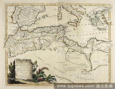
EditorialMap of the Barbary Coast from an Italian Atlas of 1779. . Atlante novissimo, illustrato ed accresciuto sulle osservazioni, e scoperte fatte dai piu? celebri e piu? recenti geografi, che ora per la prima volta si produce. Venezia, Italy. Published by ...
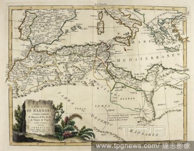
EditorialMap of the Barbary Coast from an Italian Atlas of 1779. . Atlante novissimo, illustrato ed accresciuto sulle osservazioni, e scoperte fatte dai piu? celebri e piu? recenti geografi, che ora per la prima volta si produce. Venezia, Italy. Published by ...
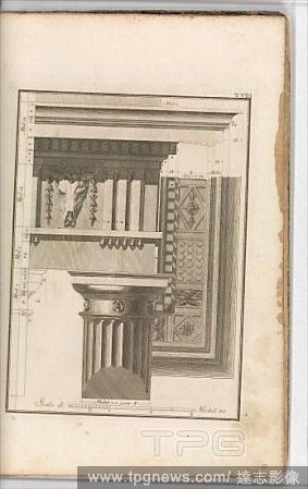
EditorialIl Vignola Illustrato Proposto da Giambattista Spampani, e Carlo Antonini, 1770, Printed book with etched illustrations and head and tail pieces made by woodcut and engraving, 13 13/16 x 9 5/8 x 1 9/16 in. (35.1 x 24.4 x 3.9 cm).


 Loading